
About a year ago, the Federal Emergency Management Agency announced new flood-zone maps for Ketchikan. Those maps added many structures to the list of buildings that would need flood insurance, and prompted the Ketchikan Gateway Borough to file an appeal.
Earlier this year, FEMA produced revised new maps, with fewer properties identified as at-risk for flooding. During Monday’s borough assembly meeting, Planning Director Richard Harney said that revision has restarted the whole process.
“They revised the maps so substantially, that they have to go back through the appeal process,” he said. “So they will be coming back to town, having an open town-hall style of meeting, and then the 90-day appeal period will begin once they republish the maps in the federal registry.”
The public meeting has not yet been scheduled. Harney wrote in a memo to the assembly that it likely will happen in April or May.
If a structure has a federally-backed mortgage and is in a FEMA-identified flood zone, the property must carry flood insurance. While private insurance is available, the most common flood insurance is through FEMA’s National Flood Insurance Program.
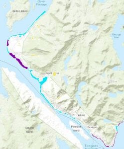
At this point, the only portion of the borough where flood insurance is required are low-lying areas within the City of Ketchikan. Those are the only areas where flood-zones had been mapped until last year. The new maps cover Ketchikan’s entire road system.
The borough appealed last year’s proposed maps because, Harney explained, the mappers didn’t consider key details, like the contours — the different elevations — of the shoreline.
“They weren’t using the contour lines,” he said. “They were just drawing straight lines across, so some structures were included even though the contour went out and around the structure.”
In his memo, Harney writes that the newly revised maps show 113 fewer structures in a special flood hazard area compared to last year’s proposed maps. Additionally, 69 homes were removed from the maps’ VE zone, which is considered the most hazardous and requires additional insurance.
Harney writes that a total of 223 structures are now in the special hazard area. That’s an increase from the old maps of just 61.
Borough Assembly Member Rodney Dial said Monday that the revised maps are the result of strong advocacy from the borough, including trips to Washington, D.C., to speak directly with FEMA and other federal officials.
“This represents a huge savings for some of our citizens. Based upon FEMA’s estimates to us, structures in VE zones in Ketchikan can have premiums exceeding $10,000 annually,” he said. “So we can legitimately say at this point that because of staff efforts as well as assembly advocacy efforts, … for just those 69 property owners, if they each receive just an $8,000 reduction for being moved out of the VE zone, that’s over half a million dollars annually.”
Dial has been one of the assembly members who travels to Washington, D.C., to advocate on behalf of the borough.
The revised maps still need to go through the appeal process. The maps also have not yet been officially published, although there are samples online.
Below is a link that shows this year’s revised map and last year’s proposed map. The link also has a search feature for individual addresses.
http://www.arcgis.com/home/webmap/viewer.html?layers=c006b3ae37644688a824283c35c9b788


