
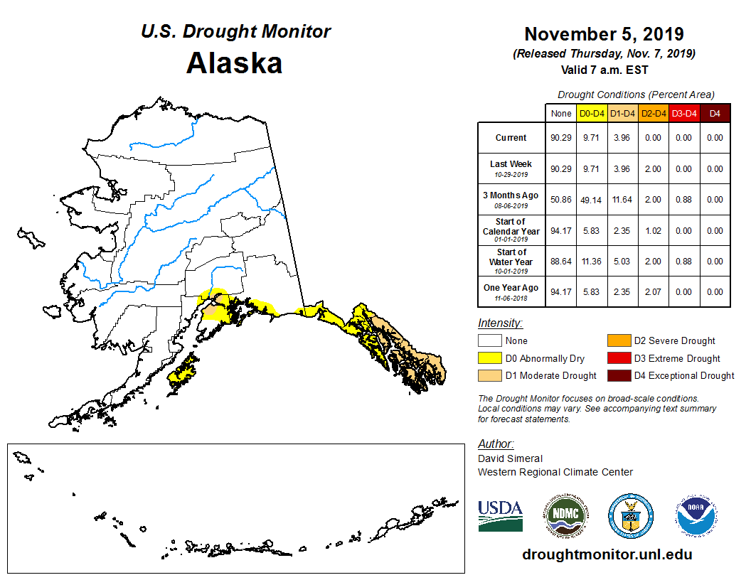
Rains throughout October and November mean Southeast Alaska is finally out of “severe drought” status for the first time since September of 2018, according to the U.S. Drought Monitor.
However, places like Ketchikan, Wrangell and as far north as Juneau are still in “moderate drought.” Places like Sitka, Hoonah and Haines remain “abnormally dry,” though not in drought.
Ketchikan International Airport, traditionally one of the wettest places in Alaska, got more than 20 inches of rain in October and has seen nearly 10 more since the beginning of November.
Wetter conditions also mean Southcentral’s drought continues to abate. Drought eased for Wasilla and Kodiak Island in October, though conditions remain abnormally dry. Anchorage and the northern Kenai Peninsula are still in moderate drought.
Forecasters expect drought conditions in Southeast to continue to improve throughout the winter. They also say Southcentral could be out of drought by the end of November.
The U.S. Drought Monitor combines rainfall measurements with stream flow, soil moisture and other factors to determine a region’s drought status.
This story was produced as part of a collaboration between KRBD and Alaska’s Energy Desk.


